
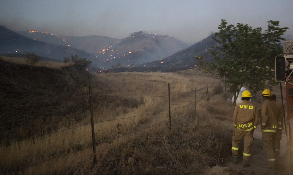


To help property owners assess fire threats, the Oregon Department of Forestry recently released a new, detailed map of every area of the state but for residents of Malheur County, the risks of wildfire season are nothing new.
The map – the Oregon Wildfire Risk Explorer – is the result of a collaborative effort between Gov. Kate Brown’s office, the Forestry Department, Oregon State University, and the Oregon State Fire Marshal. It can be found on the Forestry Department’s website.
“It really marked a transition of the thinking of the way we’re tending to fire in Oregon from a more reactive position to proactive position,” said Doug Grafe, state wildfire programs director in a press conference on July 5. “The release of the map today is an expression of that. Now, we’re not only simply going to react to wildfires in Oregon, but we’re gonna take a proactive stance to mitigate and prevent the catastrophic risk of wildfire across Oregon.”
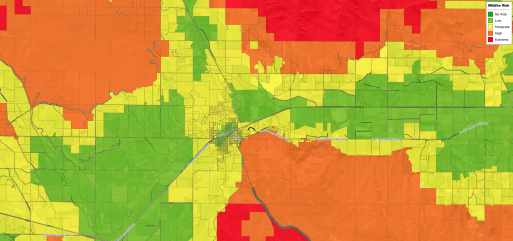
The map, available online, accounts for all 1.8 million Oregon tax lots. Any Oregonian interested in assessing their property’s risk from wildfire can enter their address into the Oregon Explorer Map tool and see how their home compares to their neighbors. After entering their address, a homeowner has the option of producing a homeowner’s report that will let them know the risk categorization of their property, if their property is within the wildland-urban interface, the risk, and the major elements that went into determining the risk classification.
The map classifies properties as low, moderate, high, or extreme risk. Oregon State experts were directed by Oregon Senate Bill 762 to base these risk classes on weather, climate, topography, and vegetation. Property owners who want to dispute their risk classification will have an appeal process available to them.
While the map is used right now predominantly to let Oregonians assess their own risks, the impacts of the risk categories will affect building codes that will be announced later this year.
In an email to the Enterprise, Chris Paul, fire risk reduction specialist in the state fire marshal’s office, said “The map will be helping to guide the new Defensible Space Code that will be coming out around the end of the year. This new code will apply to areas that have been identified as either High or Extreme AND identified as being in a Wildland-Urban Interface (WUI) area. The AND is important here.”
Property owners who fall into the overlap between the wildland-urban interface and high and extreme risk ratings will be notified by the Office of the State Fire Marshal that their defensible space and building codes will change. Property owners can look ahead by downloading the Oregon Explorer’s homeowner’s report.
“The big thing to note is that that code is still under development. It is following the same fire code process and multiple open committee meetings. If folks have questions, they can always reach out to our office,” said Alison Green, public affairs director for the Office of State Fire Marshal. The Forestry Department will be hosting community informational sessions in Eastern Oregon in Bend, The Dalles, and La Grande August 2 – 4.
Only 4.4% of Oregon’s land is within the wildland-urban interface and roughly 5% of Oregonian homeowners will experience changes due to these regulations.
In Malheur County, the city of Jordan Valley falls heavily into this overlap, as does some rangeland outside of Vale and Ontario.
There is also the possibility that risk assessment categories could affect Malheur County residents’ ability to obtain homeowner’s insurance that covers wildfires.
“For the last four years we’ve already been using mapping because of the wildfires and the costs,” said Paul Bentz, the owner of Bentz insurance in Vale. “I’m sure there’s some who have had to go without insurance because of the wildfire risk.”
Grafe said during the press conference that the “insurance market in Oregon is currently very robust,” state officials haven’t seen a high increase in property owners moving into their fair insurance program, which is available for those who aren’t able to find homeowner’s insurance in the market.
Bentz noted that Malheur residents are resilient to wildfire and have far more experience and infrastructure to combat them. The resources available in Malheur include the local rangeland fire protection associations, fire departments, and Vale Bureau of Land Management.
“Malheur builds for practicality and not aesthetics,” said Bentz. “These local agencies have done a great job of fighting fire.”
This means changes to defensible space regulations could change very little for many residents in the wildfire-urban interface risk overlap because community awareness and preparedness for wildfire is already high.
“This is important because it allows every Oregon resident an opportunity to understand the risk of wildfire where they live and to mitigate against those risks,” said Mike Shaw, Forestry Department fire protection chief, during the press conference.
Residents concerned about the status of their property can view the Wildfire Risk Map at HERE, and view the Department of Forestry’s page on the map HERE. Those interested in appealing their risk assessment categorization should reach out to the Oregon state fire marshal.
News tip? Contact reporter Mac Larsen at [email protected]
EXCELLENCE IN JOURNALISM – Available for $7.50 a month. Subscribe to the digital service of the Enterprise and get the very best in local journalism. We report with care, attention to accuracy, and an unwavering devotion to fairness. Get the kind of news you’ve been looking for – day in and day out from the Enterprise.